Entry No. 130 — the Denver file — filed under: outdoor
Castlewood Canyon Dam Ruins
“a 15-foot wall of water tore loose at 1 a.m. … and roared 40 miles down Cherry Creek”
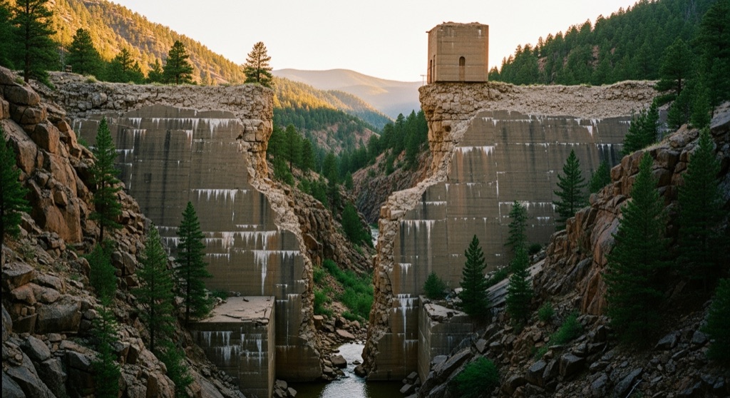
The crumbling concrete shell of the 1890 Castlewood Dam still stands in two massive broken halves, the gap between them marking the exact point where a 15-foot wall of water tore loose at 1 a.m. on August 3, 1933, and roared 40 miles down Cherry Creek to flood downtown Denver. You can walk right through that breach on established trails while the canyon walls and stunted pines make it feel genuinely remote and eerie.
The move: Hike the Castlewood Canyon Ruins Loop (roughly 2 miles) at dusk — pick your way through the broken dam gap, scramble up to the top of the standing east abutment for a panoramic view of the canyon, then find a quiet ledge along Cherry Creek below the ruins to sit with a thermos and watch the light fade over the same streambed that carried the flood.
📍 Before you go The ruins sit inside Castlewood Canyon State Park, so a daily vehicle pass is required (self-service stations at the gate — bring it). Use the main east entrance off Highway 83 in Franktown, where the visitor center and paved Canyon Point lot are; the breach is an easy walk in via the Inner Canyon/Lake Gulch loop. (A separate gravel west entrance off Castle Rock doesn't connect by car.) There's no parking at the dam itself — you hike to it. Best in spring through fall; the park closes at dusk, so a sunset visit means timing the gate — check seasonal hours ahead. Pair it with Castle Rock's restaurants a short drive west.
- 📍 Franktown
- 💸 Free
- ⚡ Up for anything
- 🌗 Outdoors
Where: 2989 S State Hwy 83, Franktown, CO 80116
Hours: Mined 2026-06-07 — confirm current hours before you go.
Plan a visit & invite your people →
Further reading: cpw.state.co.us · coloradoencyclopedia.org · Tripadvisor
last checked: 2026-06-07