Entry No. 30 — the Sierra Vista & Fort Huachuca file — filed under: miscellanea
Brunckow's Cabin
An eerie desert ruin known for a long legacy of violence, mining disputes, and notorious ghost stories.
The story
Frederick Brunckow was a German mining engineer who fled Prussian treason charges, wandered west, and staked an isolated silver claim eight miles southwest of what is now Tombstone in 1858. He built a low adobe outpost and sank prospect shafts into the caliche dirt. In the summer of 1860, the camp collapsed into slaughter: Brunckow was run through with a heavy iron rock drill and dumped down his own mine shaft, while two of his companions were butchered nearby. The camp cook, David Bontrager, survived hostage-taking to report that their Mexican workforce had looted thousands of dollars in supplies and fled across the border.
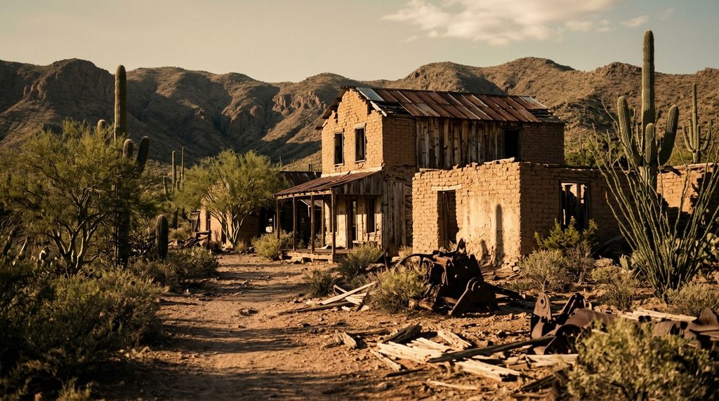
The bloodshed did not stop with its namesake. In 1874, former U.S. Marshal Milton Duffield showed up waving a disputed deed and was blown away on the cabin grounds by a rival claimant named James Holmes. Three years later, a lone prospector named Ed Schieffelin slipped into the bullet-riddled adobe to use it as a fortified base camp, melting and assaying silver ore in Brunckow's stone fireplace. That ore sparked the boom that created Tombstone. By then, fresh graves were already clustering around the walls, and 1880s territorial newspapers quickly crowned it the bloodiest cabin in Arizona, alleging that up to twenty-one men had met violent ends in and around the dirt.
Tombstone tourism packages the sanitized gunfights, but Brunckow's is where the real carnage started—and it is completely abandoned to the elements. What survives sits on BLM land: eroding adobe wall stubs (likely the operation's fortified storeroom rather than the main house) sitting atop a quiet ridge surrounded by forgotten mine holes fading back into the scrub.
What it's like
There are no signs, no entry fees, and zero shade. You pull off paved Charleston Road at the South Brunckow Road turnoff, park under the overhead power lines where the dirt track is gated to vehicles, and head southwest on foot for about a half-mile across a wash. The ground is scattered with loose stone, prickly pear, and unfenced historic mine holes, so you need to look where you step and keep dogs on a short lead. At the rise, you'll find the low adobe stumps sitting in total desert quiet. Visit on a winter morning; in summer, the exposed caliche basin turns into an oven.
The move: Park beneath the power lines and trek across the wash, watching your step around prickly pear and open mine shafts, to stand among the blood-soaked adobe ruins of Brunckow’s Cabin.
- 📍 Tombstone
- 💸 $$
- ⚡ Up for anything
- 🌗 Indoors
Where: Southwest of Tombstone on BLM land near Charleston Road (approx. 7-8 miles SW of Tombstone; GPS approx. 31.6386° N, 110.1575° W)
Hours: Added 2026-11-18 — confirm current hours before you go.
Pair it with
- Millville Historic Townsite and Rock Art Discovery Trail — Just a mile down Charleston Road, Millville is where the silver Ed Schieffelin mapped from Brunckow's hearth was hauled down to the river to be crushed by heavy stamp mills.
- Historic Clanton Ranch Ruins on the San Pedro — Follow the San Pedro River south to find the crumbling adobe home base of the Cow-boy faction that operated in this same violent valley.
- Boothill Graveyard — Head eight miles northeast into Tombstone to see the manicured cemetery where victims of the era's disputes were buried, in stark contrast to the unmarked desert graves around Brunckow's.
More weird in Sierra Vista & Fort Huachuca
Good to know
How do you hike to Brunckow's Cabin?
Park in the small pullout along Charleston Road near South Brunckow Road (by the BLM administrative gate), then follow the informal footpath southwest across the wash for approximately 0.4 miles up to the ruins.
Is it free to visit?
Yes. The ruins sit on public land managed by the Bureau of Land Management within the San Pedro Riparian National Conservation Area, open for free day use.
Are the mine shafts near the cabin safe?
No. The surrounding ridge is pocked with deep, historic mine cuts and prospect shafts left over from the 1850s to 1880s. Do not walk backward, stay on visible footpaths, and do not attempt to descend into any openings.
What is the cabin's connection to Tombstone?
Tombstone founder Ed Schieffelin used the cabin as his base camp in 1877, using its hearth to assay the first rich silver strikes that birthed the town of Tombstone.
Plan a visit & invite your people →
Further reading: seniortrails.com · Wikipedia · tombstonetraveltips.com · bisbeehistory.com · backcountrypost.com · azoffroad.net
last checked: 2026-11-18