Entry No. 28 — the Sierra Vista & Fort Huachuca file — filed under: miscellanea
Millville Historic Townsite and Rock Art Discovery Trail
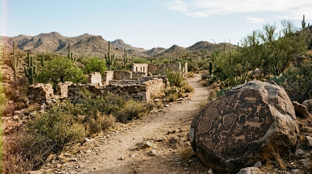
This desert trail winds through the stone foundations of an old Tombstone silver-boom mill town and leads past ancient Hohokam petroglyphs etched onto rock surfaces.
The story
Tombstone had all the silver in the Arizona Territory, but it had a fatal engineering problem: no water. In 1879, mining engineer Richard Gird and prospectors Ed and Al Schieffelin solved the impasse by carting raw ore nine miles downhill in heavy mule wagons to the east bank of the north-flowing San Pedro River. At Millville, they built two thunderous stamping facilities—the Gird and Corbin mills—where iron stamps crushed rock into fine flour around the clock. In peak months between 1881 and 1882 alone, Millville pounded out roughly $1.3 million in refined silver bullion. Across the shallow river stood Charleston, the unruly bedroom and saloon community where mill hands and outlaw Cowboys drank, fought, and plotted holdups. Gird was cagey enough to install an immense decoy safe in his Millville company office, quietly bricking the real silver bars into hidden wall cavities papered over to match the parlor walls.
The bluff didn't stay quiet for long. In March 1882, two masked bandits stormed the Millville office and shot young company engineer Martin Peel dead on the floor, fleeing empty-handed after failing to find where Gird had stashed the payroll. But the town's demise came from underground, not outlaw pistols. In the mid-1880s, Tombstone's deep mine shafts struck subterranean water, giving the mines on-site processing water and rendering distant river mills obsolete. By 1889, both Millville and Charleston were entirely abandoned, leaving high stone foundations, slag terraces, and masonry walls to erode under the desert sun.
What the 19th-century silver rushers treated as cheap industrial real estate was an ancient crossroads long before they arrived. Between roughly 300 BC and AD 1450, Hohokam farmers settled this stretch of the San Pedro. On dark basalt boulders scattered right beside the ruined millworks and along the upper trail, they pecked hundreds of petroglyphs through the desert varnish: geometric lines, coiled spirals, and bear tracks. The Bureau of Land Management later installed fixed sighting pipes beside the trail so you can aim through the metal cylinders and spot faint carvings on the far hillside without scrambling through rattlesnake cover.
What it's like
Park at the dirt lot on the north side of Charleston Road, just past the county fire danger board, where you'll find a BLM kiosk and a vault toilet. The 1.8-mile trail is an unshaded dirt and caliche track that dips across a dry desert wash before winding up to the mill ruins and rock faces. You will walk directly alongside the massive, hand-cut stone terraces of the Gird and Corbin mills before reaching the sighting tubes that frame the Hohokam rock art on boulders across the gully. There is zero cover out here, and the Cochise County sun reflects fiercely off the exposed rock, so bring water, wear sturdy soles for loose gravel, and stay alert for snakes in the wash.
The move: Hike the unshaded caliche trail across the dry wash to explore the towering stone foundations of 1880s silver stamping mills and ancient Hohokam petroglyphs etched into the rocks.
- 📍 Sierra Vista
- 💸 Free
- ⚡ Up for anything
- 🌗 Outdoors
Where: Millville Parking Area, Charleston Road (approx. 7.5 miles east of Sierra Vista, north side, near fire danger sign, 0.5 miles east of San Pedro River bridge), Sierra Vista, AZ 85635
Hours: Added 2026-11-18 — confirm current hours before you go.
Pair it with
- Brunckow's Cabin — Just a short drive east on Charleston Road toward Tombstone, this desolate adobe ruin marks the bloodiest pre-boom mining camp in Cochise County history.
- Historic Clanton Ranch Ruins on the San Pedro — Drive a few miles south along the river corridor to see the foundations where the outlaw Cowboys who caroused through Charleston and menaced Millville kept their cattle.
- Murray Springs Clovis Archaeological Site — Pair Millville's Hohokam petroglyphs with Murray Springs just up the San Pedro valley, where Clovis hunters butchered mammoths 13,000 years ago.
More weird in Sierra Vista & Fort Huachuca
Good to know
How much does it cost to hike the trail?
It is completely free. The site sits on public land within the San Pedro Riparian National Conservation Area managed by the Bureau of Land Management.
How long is the hike?
The loop trail is approximately 1.8 miles long, generally flat to gently sloping, and takes about 45 to 60 minutes at an exploratory pace.
Can you cross the river to see Charleston ghost town?
Charleston sits on the west bank of the San Pedro, but its adobe structures have largely melted into the brush, and parts of the area were historically used for military training; the preserved foundations and interpretive trail are on the Millville side.
What is the best time of day to see the petroglyphs?
Early morning or late afternoon light creates the angled shadows needed to distinguish shallow Hohokam carvings against the dark rock face.
Plan a visit & invite your people →
Further reading: Official site · permanent.fdlp.gov · maps.roadtrippers.com · blm.gov · tombstonesilver.com · scihistory.info
last checked: 2026-11-18